Centimetre-grade orchard mapping across European borders.
Agriconnect embeds automated post-processing via API to reference tree data with absolute spatial accuracy.
Summary
Agriconnect, based in Peyruis in the south of France, builds Cclair, the first French service for variable-rate orchard thinning driven by flowering-density mapping.
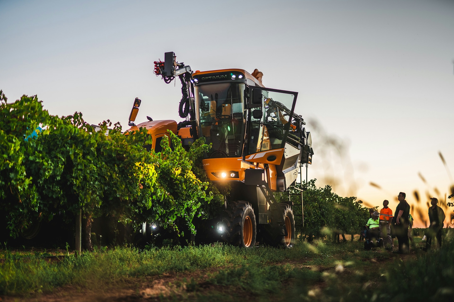
As a tractor-mounted unit drives the rows, its cameras and GNSS record the flowering intensity and position of every tree, and the Cclair web app turns that into a treatment map that market-standard spray consoles apply automatically.
The agronomic payoff growers report is significant, so the maps have to be trustworthy, which means every tree must be pinned to the right spot. Operating across France, Italy and Spain, Agriconnect struggled with inconsistent national GNSS base-station data and a different workflow in every country.
By integrating the Rinexlab virtual base station through our API, it now post-processes its camera trajectory (PPK, post-processed kinematic) against a base placed at the centre of each field, georeferences every tree to survey-grade, centimetre-level accuracy, and runs a single automated positioning workflow across all three.
The partner
Agriconnect, headquartered in Peyruis in the Alpes-de-Haute-Provence, builds precision-agriculture tools for arboriculture. Its Cclair service, recognised with a Bronze award at the 2024 SIVAL Innovation competition, is billed as the first French service for variable-rate thinning (éclaircissage) based on flowering-density mapping, and works in both conventional and organic orchards.
An onboard acquisition unit mounts to the front of the tractor and, using GNSS and motorised cameras, photographs every tree in the block and grades its flowering intensity across several density levels.
That map feeds the Cclair web app, where the grower sets a thinning strategy per flowering level, and Cclair generates modulation files compatible with market-standard guidance consoles.
Because thinning regulates crop load tree by tree, the prescription has to land on the right trees, so the positioning behind it must be accurate and consistent in every country Agriconnect works in. Growers using Cclair report meaningful gains in yield and reductions in both chemical thinning inputs and manual thinning time.
The challenge
A thinning map is only useful if each tree sits in the right place. That makes accurate georeferencing of every tree the foundation of the whole Cclair service, and that foundation was hard to lay consistently across borders.
Working across France, Italy and Spain, Agriconnect ran into three connected problems. Consistent GNSS base-station data was difficult to source from local providers in each country.
Maintaining a different correction workflow per region added real operational complexity. And because the correction sources varied, so did positioning accuracy, the one thing the thinning maps could least afford to lose.
One RINEX source, everywhere they work
The decisive factor was removing the per-country dependency. Instead of sourcing and managing base-station data separately in France, Italy and Spain, Agriconnect needed one reliable source of RINEX that behaved the same wherever a field happened to be.
The Rinexlab provides exactly that: a virtual base station (a virtual reference station) service that delivers a RINEX file (the standard GNSS observation format used for post-processing) for a base placed wherever it is needed, in Agriconnect’s case the centre of each field, through a single API. Positioning the base at the field centre keeps baselines short, which helps resolve ambiguities to a fixed, centimetre solution; and one uniform source across the operating area removes the variability that had been eroding accuracy before.
Just as important, the Rinexlab is built to be integrated rather than operated by hand. Because it is reachable by API, it can sit inside Cclair’s existing pipeline and be called automatically for every field, instead of being a manual step a person has to manage country by country.
The solution in practice
Agriconnect integrated the Rinexlab directly into the Cclair workflow through our API. For each field, the pipeline automatically requests a RINEX file for a virtual base station positioned at the centre of that field. There is no local base to set up and no per-country provider to coordinate. The base comes from a single source on demand.
With that virtual base in hand, Cclair post-processes the GNSS rover data (PPK, post-processed kinematic) to produce a high-precision trajectory for the camera as it moves through the orchard. Because the trajectory is resolved against a short-baseline virtual base, more of it lands on a fixed (ambiguity-resolved) centimetre solution, which is what lets the system georeference every tree to survey-grade accuracy.
The georeferenced video then feeds the algorithm that produces the flowering-density and thinning maps.
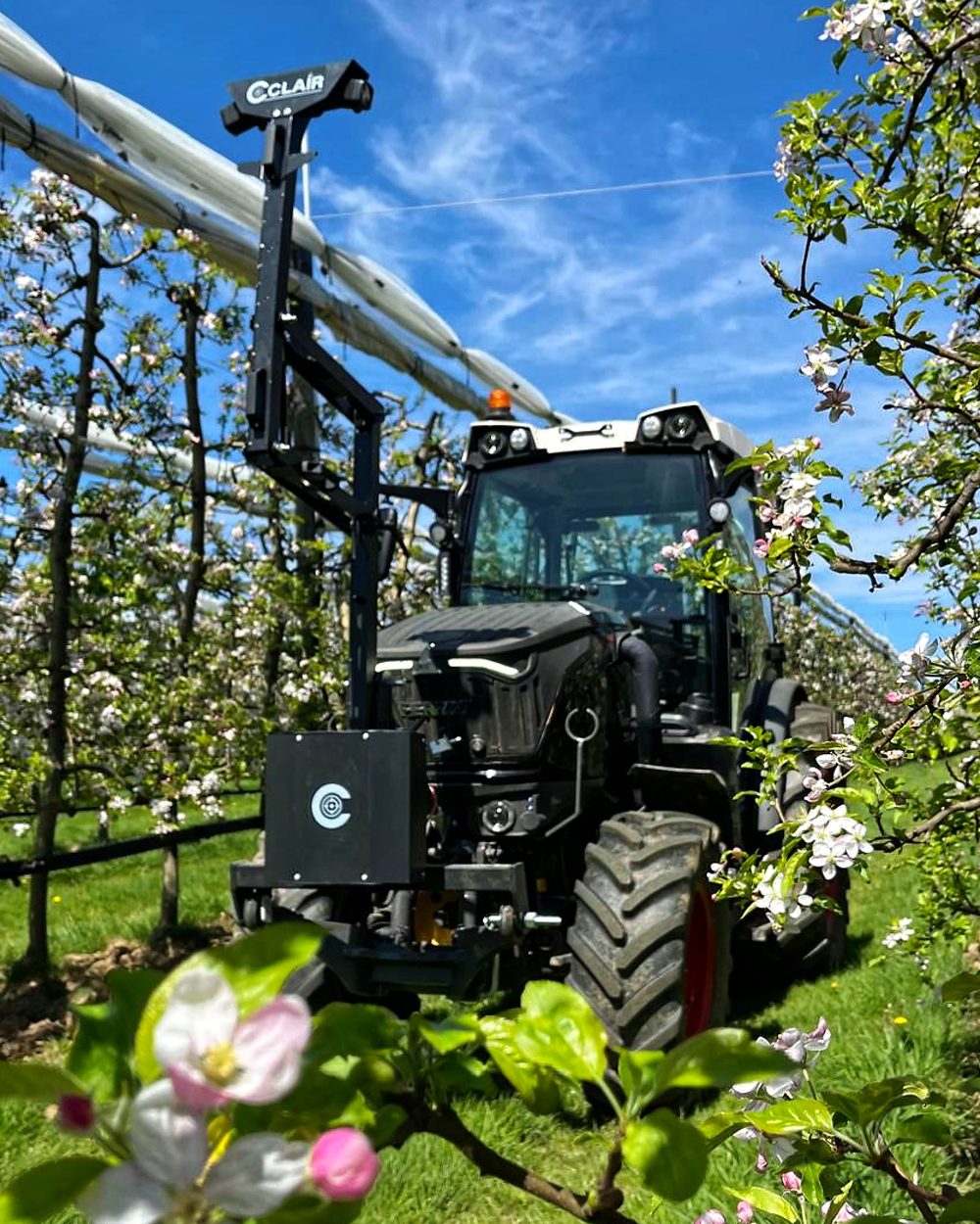
The loop closes back in the field. That mapping stage is post-processed; the spraying stage is real-time. When operators return with the sprayer working in real-time RTK fix mode, the console applies the thinning treatment automatically according to the pre-defined map, the right dose on the right trees, on positioning that was consistent from the start.
The results
- One unified positioning workflow across Europe, with no need to source or manage different RINEX providers per country, the operational complexity that drove the project is gone.
- Operational cost savings from automation and reduced coordination overhead, because the virtual base is requested by API rather than arranged by hand for each region.
- A +20% higher fix rate, more of the post-processed trajectory resolved to a fixed centimetre solution, achieved even with lower-end GNSS chipsets, so better results without forcing a hardware upgrade.
- Survey-grade, centimetre-level georeferencing of every tree, turning the obstacle that limited the maps into a dependable foundation for them.
- Higher delivery quality overall, with precise and consistent treatment from flowering-density mapping through to variable-rate thinning in the field.

One source of RINEX, anywhere you operate.
Connect your hardware profile.